Saturday, August 24, 2019

Radiosonde launches in Santa Cruz

The OTREC project started launching radiosondes in Santa Cruz on August 21st and we will launch radiosondes twice a day, at 6am and 6pm, until the end of September. The launching is held at the Santa Cruz UCR campus, and will be performed mostly by graduate students.
        On August 20th, graduate students Zeyuan Hu (Harvard), Justin Whitaker (CSU), and I (Texas A&M), together with PI David Raymond (NMT), headed out to Santa Cruz to start the radiosonde launches. The first launch, led by David Raymond, started around 5:30 pm and ended around 8:30 pm. Why did it take so long? We needed to set up the portable radiosonde receiver (antenna) and software, inflate the balloon with helium and attach the radiosonde, launch and then wait until the balloon reached 18 km in altitude. During this time, the antenna received information about air temperature, humidity, and wind speed and direction at different altitudes. This information will help OTREC to understand the mechanisms of atmospheric convection in the far Eastern Pacific.

Preparing the first radiosonde in Santa Cruz, from left to right: Zeyuan Hu, me, and PI David Raymond
        For a few days, Zeyuan and I were in charge of the radiosondes launches. We woke up at 5:30 am, headed out to the UCR campus, and launched the radiosonde around 6:30 am. Sometimes we experienced minor issues related to the iMet software or radiosonde that delayed the launch by a few minutes; however, we were able to launch all the radiosondes successfully.
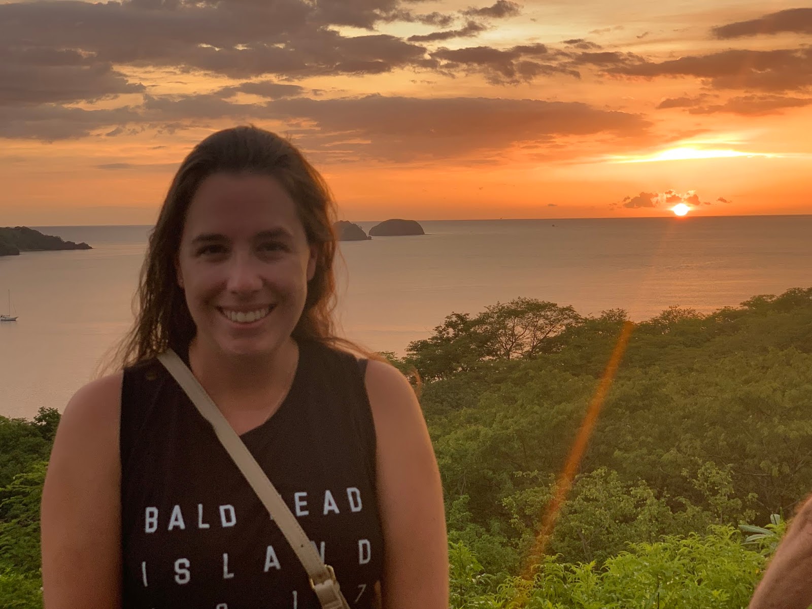
Me, holding the first balloon to be launched
OTREC Team in Santa Cruz, from left to right: David Raymond, Zeyuan Hu, me,  and Justin Whitaker
The UCR has also an elementary school at this campus, and some of the students joined us to see the balloon going up – it was their favorite part! They were enthusiastic students that wanted to learn about our work and project. They understood that the balloon has a sensor that measures air temperature and winds at different altitudes, and the surface temperature is not the same as it is at 5 km or 10 km.   
Here I am, talking with the first two kids who came to us during the radiosonde launch; Justin Whitaker is on the right 
OTREC also aims to encourage these students to like science as much as we do. In fact, the OTREC team will speak with all the students and teachers early this week, and we will bring educational material to be distributed throughout the school.
Having a chat with elementary school students about OTREC and weather; in the back, PI David Raymond is smiling
 The radiosonde launches in Santa Cruz are underway and will continue until the end of September. Zeyuan Hu and I are in charge of 10 launches. After that, I will take a few days off (though I will probably be in charge of weather discussions) and then come back for more launches with my next partner, Justin Whitaker. 


Friday, August 23, 2019

Once, twice, thrice: Flying past the same convective system three times

I'm writing this post from the Atlanta airport, where I am waiting for my connecting flight home from Costa Rica. I had a great week participating in OTREC - it was so great that I delayed my departure for a day so that I had a chance to go on a second research flight - this time, on the NCAR/NSF G-V, on Thursday August 22, 2019.
Me outside the plane in my stylish high visibility safety vest.
The G-V was pretty different than the NOAA P-3 I had flown on earlier this week (see my previous blog post about that flight)! It flew more than twice as high (41,000-45,000 ft. vs. 10,000-20,000 ft), was a smoother ride (though a smaller plane), and was much more luxurious. I particularly liked the seats that swiveled, so you could get a bird’s eye view out of the expansive windows, or could turn around to face a workstation where you could monitor the latest data from the flight.
The swivel chairs! Great for observing clouds through the window. 
After about an hour delay due to fog at the airport, we took off and flew the “B1” pattern, in which we flew back and forth in a box near the Colombia coast and then back and forth in a box in the Caribbean near the Panama and Costa Rica coasts. The first part of our flight, in the Colombian box, the skies were very clear, with just some scattered shallow cumulus. The radar returns looked like static – there were no clouds to see! But this meant that we had a great view of ships, the Andes Mountains in Colombia, and the Panama Canal.
Mostly clear skies. Near the center of the image is a ship (you can see its wake in the water).
The Colombian coastline, and the Andes Mountain Range in the distance. 
The Panama Canal

But then as we crossed over to the Caribbean, convection picked up. A deep convective system had formed, with cloud tops just about at our flight level. As we maneuvered around the convection and continued on our flight pattern, we ended up flying past that same convective system three times, allowing us to view it from three different angles. Viewing it from the side was almost like getting an inside look at the structure of the convective system.
Our first pass, to the east of the convective system, with near textbook structure.  
Radar returns as we flew over the edge of the anvil cloud - the pinks indicate cloud particles!
Our second pass, from the north of the convective system. Notice how there are multiple thunderstorms embedded within  the system.
Photo of our flight path (red dot in the upper right shows our current location) with infrared satellite imagery in the background. The bright right blob in the top right of the image (the smaller of the two) is the convective system we flew past three times.  
Headed towards our third pass by the convective system, this time  to its south and west. 
On our last pass, we had a perfect view of the “overshooting tops”.  Most of the cloudy air stops rising when it is no longer more buoyant than the surrounding atmosphere, which for deep convection occurs when the rising air runs into the more stable air in the tropical tropopause layer. The cloudy air then diverges outward, forming a spreading anvil cloud. But some of the rising air has enough momentum to bubble up a bit further; these are known as “overshooting tops” and are the bubbles of cloud above the otherwise flat top of the cloud.

About to enter the cloud shield. We were flying just at the level of the cloud tops. Notice the extra bit of cloud bubbling up above the otherwise flat anvil cloud top.

Overshooting convection. 
All in all, it was a great flight and a great end to my time with OTREC in Costa Rica!

A gorgeous sunset to end my time with OTREC. 


Wednesday, August 21, 2019

The Coin-Flip: Unbiased Scheduling in the OTREC GV Flights


On August 17, the day I came aboard the Gulfstream V (GV), the conditions along the coastline of Costa Rica in the Eastern Pacific were rather placid. From out the windows, we were met with views of trade cumulus clouds, stretches of open sea, and the occasional isolated shallow cumulus cloud. No signs of organized deep convection were in sight, except for those in the distance that our colleagues aboard the NOAA P-3 Hurricane Hunter were investigating. Why would a project focused on the nature of deep convection spend time to observe areas without convection? Well, to understand deep convection, we also must understand why it doesn’t happen.


Figure 1: An image taken from the GV flight over the Eastern Pacific on 8/17

When planning this project, the PIs decided that it would be vital to study a variety of conditions in the regions of concern. We couldn’t let our bias command the schedule to the point where the GV would solely chase deep convection. OTREC had to look at the full spectrum of conditions in order to understand what factors in the Eastern Pacific and Caribbean lead to conditions where we see little or no deep convection, widespread and organized deep convection, and everything in between

For this reason, the project developed an unbiased system to schedule the GV flights. The GV usually flies lawnmower patterns within two boxes of interest, one (B2) in the Eastern Pacific off the coastline of Costa Rica, and another (B1) which spans in two regions, one in the Caribbean (B1b) and one off the eastern coast of Colombia (B1a) (see the picture below).


B2
 
B1a
 
B1b
 

Figure 2: The GV flight operation boxes

In the flight schedule, the GV flies within the B1 box first, and the next day, it flies within the B2 box. After the B1 flight, the fate of this two-day flight schedule is left up to the epitome of fairness… a coin flip. The coin flip determines how many days we take in between the last B2 flight and the next B1 flight. The PIs, Dave and Zeljka, take a coin and flip it four times. Each head represents one day. Once the number of heads they flip is counted, we add one extra day. This give us the possibilities of having one to five days between the B2 and B1 flights. For the sake of GV maintenance and the restricted schedule, breaks of one and five days can only occur once.

After our latest B2 flight on 8/17, the pilots got to take a turn in flipping the coin to determine when the GV would take to the air next. To their dismay, they got four heads! Four plus one leaves us five days before we hit the skies again. However, since we’ve already taken a five-day pause, the plan is to take a four-day break; we’ll be back with more data from our B1 region this Thursday!

Nuqui-Team (second shift):  From the heart of the rainiest place on earth Nuquí is a coastal town, located over western Colombia. It i...